Negril
Negril is a small (pop. 6,900) but widely dispersed beach resort and town located in Westmoreland and Westmoreland ONLY. However the Negril Beach extends from the town across the Border of Hanover. Hanover parishes are at the far western part of Jamaica, 80.8 km southwest from Sangster International Airport in Montego Bay.
Westmoreland is the westernmost parish in Jamaica, located on the south side of the island. Downtown Negril, the West End cliff resorts to the south of downtown, and the southern portion of the so-called seven mile (11 km) beach are in Westmoreland Parish. The northernmost resorts are along the Negril Beach and are nearer if not across the border where Westmoreland Parish meets the Hanover Parish. The nearest large town is Savanna-la-Mar, the capital of Westmoreland Parish if traveling South West. Whereas going in the opposite direction along the A1 highway is Lucea, the Capital Town of Hanover.
Westmoreland is the westernmost parish in Jamaica, located on the south side of the island. Downtown Negril, the West End cliff resorts to the south of downtown, and the southern portion of the so-called seven mile (11 km) beach are in Westmoreland Parish. The northernmost resorts are along the Negril Beach and are nearer if not across the border where Westmoreland Parish meets the Hanover Parish. The nearest large town is Savanna-la-Mar, the capital of Westmoreland Parish if traveling South West. Whereas going in the opposite direction along the A1 highway is Lucea, the Capital Town of Hanover.
Map - Negril
Map


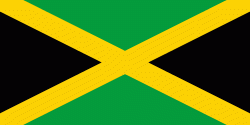
Country - Jamaica

Currency / Language
| ISO | Currency | Symbol | Significant figures |
|---|---|---|---|
| JMD | Jamaican dollar | $ | 2 |
| ISO | Language |
|---|---|
| EN | English language |